History of the Appia
The Appian Way, or Appia longarum regina viarum in Latin, meaning “Queen of the Long Roads,” was one of the first long roads to be completely paved. Construction of the Appian Way began in 312 BC, first from Rome to Capua and then to Benevento and Brindisi.
The reason for building the road was that during the First Samnite War (343-341 BC) the Romans realized they could not support or supply their troops well in the field against the Samnites through the marshes south of Rome. A revolt by the Latin League further drained their resources. They gave up and made an agreement with the Samnite people
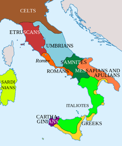
The Second Samnite War (327–304 BC) began when Rome attempted to establish a colony at Cales (near Capua) in 334 BC and again at Fregellae (near Frosinone) in 328 BC, further inland in the marshy area. The Samnites, now a major power after defeating the Greeks of Taranto, occupied Neapolis to try to secure its loyalty. The Neapolitans appealed to Rome, which sent an army and drove the Samnites from Naples.
When Appius Claudius Caecus, a patrician of illustrious lineage, was elected censor in 312 BC, he began to undertake bold public works and projects without waiting for instructions from the Roman Senate. By far his best-known project is the road through the Pontine Marshes to the coast northwest of Naples, where it turns north to Capua. On it, unlimited numbers of fresh troops could be dispatched to the theater of operations, and supplies could be moved en masse to Roman bases without hindrance from the enemy or the terrain.
The new road achieved its goal. The outcome of the Second Samnite War was finally favorable to Rome. In a series of blows the Romans turned the tide, bringing Etruria to the negotiating table in 311 BC, the same year of their revolt, and Samnium in 304 BC. The road was the major factor in allowing them to concentrate their forces quickly enough and keep them adequately supplied, after which they became a formidable opponent.
The reason for building the road was that during the First Samnite War (343-341 BC) the Romans realized they could not support or supply their troops well in the field against the Samnites through the marshes south of Rome. A revolt by the Latin League further drained their resources. They gave up and made an agreement with the Samnite people
The original starting point of the Via Appia in the valley of the Camenae
When the Appian Way was built in 312 BC, the road started from the Servian Walls and the Camenae Gate, as it was probably called. In Roman mythology, the Camenae were originally goddesses of childbirth, wells and fountains, as well as prophetic deities. The valley where the gate was located is now the avenue of the Baths of Caracalla. In ancient times it was covered with woods, caves and fresh water springs considered sacred and mysterious.
Since the Appian Way had the city of Capua as its arrival point, the name of the gate was changed to Capena and the entire area, already important for various reasons, took on a very important role as an important transit and contact point with southern Italy.
In the literary field, the gate is also mentioned for another important event that deeply marked the history of Rome: as reported by Titus Livius, after the disastrous battle of Cannae, the Senate met to evaluate the situation “ad portam Capenam”, which was one of the three meeting places of the assembly.
Milliarium Aureum by Augustus
At the Roman Forum next to the Arch of Septimius Severus existed the two first mile stones, called “Umbilicus Urbis Romae” linked by legend to Romulus the founder of Rome and the Milliarium Aureum a golden milestone erected by Augustus.
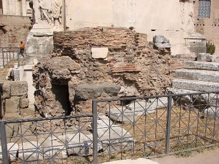
All roads were considered to begin at these monuments and all distances in the Roman Empire were measured relative to it. These are the remains of the “Umbilicus Urbis Romae” unfortunately of the Milliarium Aureum nothing is left other than two pieces which are of disputable origin.
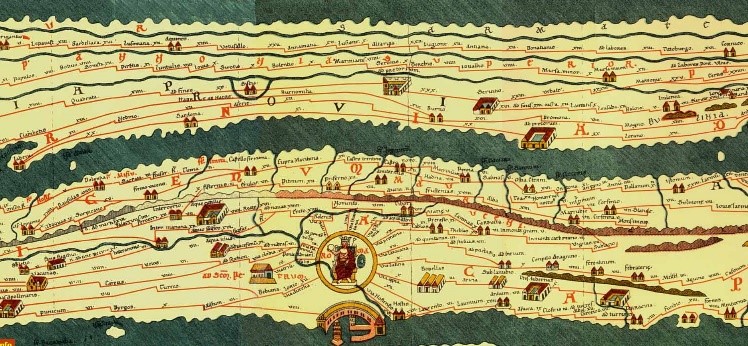
Tabula Peutingeriana
That all roads lead to Rome we can see on a 13th-century parchment copy called the “Tabula Peutingeriana” of a possible Roman original. It covers Europe (without the Iberian Peninsula and the British Isles), North Africa, and parts of Asia, including the Middle East, Persia, and India. According to one hypothesis, the existing map is based on a document of the 4th or 5th century that contained a copy of the world map originally prepared by Agrippa during the reign of the emperor Augustus (27 BC – AD 14). The map was discovered in a library in the city of Worms by German scholar Conrad Celtes in 1494, he bequeathed the map in 1508 to Konrad Peutinger, a German antiquarian in Augsburg, after whom the map is named. The Peutinger family kept possession of the map for more than two hundred years until it was sold in 1714. It then bounced between several royal families until it was purchased by Prince Eugene of Savoy for 100 ducats; upon his death in 1737, it was purchased for the Habsburg Imperial Court Library in Vienna. It is today conserved at the Austrian National Library at the Hofburg palace in Vienna.
There are many other “itineraria” and ancient maps that describe ancient roads in which indications and names correspond to that precise historical moment and therefore there is almost no direct match between the known “itineraria”.
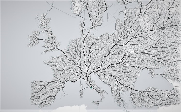
All roads lead to Rome
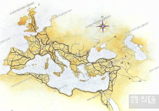
Today, modern highways and arteries have mostly replaced the ancient transit system (though some fragments still exist). Which raises the question: Do all roads still lead to Rome? moovel lab, a German urban design team, has an answer. Data visualizers layered a grid of 486,713 cells on top of an open-source digital road map of Europe.
They then developed an algorithm to calculate a route to Rome from each one of those cells, and found that yes, indeed, there was a way from every point (although it might be a stretch to say that “all roads” lead to the city). The map above shows those routes; The thicker the road segment is drawn, the more frequently that road was used across all routes.
Etruscan Roads
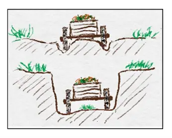
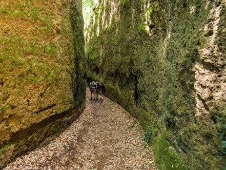
When we refer about ancient roads in Italy, we have to inform you that not all the roads around Rome have been laid out by the Romans; Before the romans and the construction of roman roads throughout Europe the Etruscans civilization which started around 900 BC and ended with the assimilation in the roman empire around 90 BC already had created a network of roads north and south of Rome. These roads were, contrary to the Roman roads not paved, but at first simple trails in the Italian landscape.
With the increase of the Etruscan population and commerce by carts drawn by animals the Etruscan roads started to sink into the landscape. This effect was created because the soft volcanic tuff stone, that had been deposited all over the area around Rome by pyroclastic volcanic eruptions in various periods before the Etruscan and Roman history, eroded through the mechanical action of the carts. The wheels of the carts stated to make deep ruts into the soil and transporting goods with carts on these roads was possible until the axles of the cart started hitting the middle of the road. The solution of the Etruscans to this problem was to dig the road deeper and deeper. Now, especially north of Rome, there are many villages with “vie Cave” or “Tagliata” some as deep as 20 meters.